Idaho Hunt Planner We got game.
Hunt Area
All of the McCall Zone. Short-Range Weapons ONLY in that Portion of Unit 24 Within the Following Boundary: Beginning at McCall at the junction of State Highway 55 and Boydstun Street, then south on Boydstun Street to West Valley Road, then west and south along West Valley Road and West Mountain Road to Cabarton Road, then north on Cabarton Road to State Highway 55, then north on State Highway 55 to Farm-To-Market Road, then north on Farm-To-Market Road to Elo Road, then west on Elo Road to State Highway 55, then north on State Highway 55 to the point of beginning.
More information about the Game Management Unit(s) in this area: 19A 23 24 24 25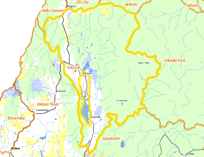
Surface Management
For government land, these data show the managing agency of the land, which may or not be the same as the owning agency.
 U.S. Forest Service (USFS) 1638.94%
|
|
Private 423.8%
|
|
State of Idaho 89.83%
|
|
U.S. Bureau of Land Management (BLM) 49.3%
|
|
Other 13.44%
|
|
U.S. Bureau of Reclamation (BOR) 9.26%
|
|
State of Idaho 1.71%
|
|
State of Idaho 1.12%
|
Make your own map of Hunt Area
Ownership data source: Inside Idaho
Access Yes! Properties
Access Yes! is Fish and Game program designed to improve hunting and fishing access to private land or through private land to public land by compensating willing landowners who provide access.
No properties are currently available in .
View all Access Yes Participants.
Forest Service Land
Check for road and area closures on National Forest websites
- Boise National Forest
- Nezperce National Forest
- Payette National Forest
- Salmon-Challis National Forest
Federally-designated Wilderness Areas
No motorized vehicles are allowed in these areas.
- Frank Church - River of No Return Wilderness 54,739 acres (63.85% of hunt area)
- Hells Canyon Wilderness 11,669 acres (13.61% of hunt area)
Land Use/Land Cover
|
Forest
1984.54
%
|
|
Irrigated-Gravity Flow
123.11
%
|
|
Rangeland
70.12
%
|
|
Water
22.82
%
|
|
Riparian
19.41
%
|
|
Irrigated-Sprinkler
6.83
%
|
|
Urban
0.57
%
|
Make your own map of Hunt Area
Land Use data source: IDWR
Towns in this Hunt Area
- McCall, Idaho 55
- Cascade, Idaho 55
- New Meadows, US 95 Idaho 55
- Riggins, US 95
- Yellow Pine, East Fork Rd.
- Warm Lake, Warm Lake Rd.