Idaho Hunt Planner We got game.
Unit 59A
- Region 6
- Upper Snake Region
- Beaverhead Elk Zone
- Units 30, 30A, 58, 59, 59A
Game Management Unit Boundary
Those portions of CLARK, JEFFERSON, and LEMHI COUNTIES within the following boundary: beginning at Bannock Pass (Clark County) on the Idaho-Montana State line, then west along the state line to the watershed divide between Birch and Crooked Creeks, then south along the divide through Reno Point to State Highway 22, then east on State Highway 22 to Medicine Lodge Road, then north on Medicine Lodge Road to Bannock Pass, the point of beginning.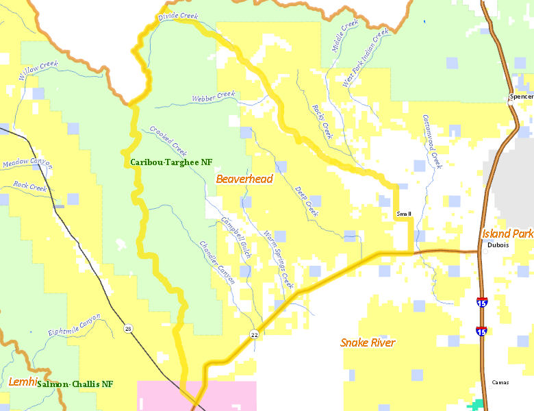
Public Access
Surface Management
For government land, these data show the managing agency of the land, which may or not be the same as the owning agency.
| U.S. Forest Service (USFS) |  43.01
%
43.01
%
|
| U.S. Bureau of Land Management (BLM) |
38.98
%
|
| Private |
14.96
%
|
| State of Idaho |
2.37
%
|
| U.S. Department of Energy (DOE) |
0.62
%
|
Make your own map of Unit 59A
Ownership data source: Inside Idaho
Access Yes! Properties
No properties are currently available in Unit 59A.
View all Access Yes Participants.
National Forests
Federally-designated Wilderness Areas
No motorized vehicles are allowed in these areas.
There are no wilderness areas in Unit 59A.
Land Use/Cover
| Rangeland |
77.91
%
|
| Forest |
17.5
%
|
| Irrigated-Gravity Flow |
3.13
%
|
| Irrigated-Sprinkler |
1.43
%
|
Make your own map of Unit 59A
Land Use data source: IDWR