Idaho Hunt Planner We got game.
Palouse Zone
Units 8, 8A, 11A
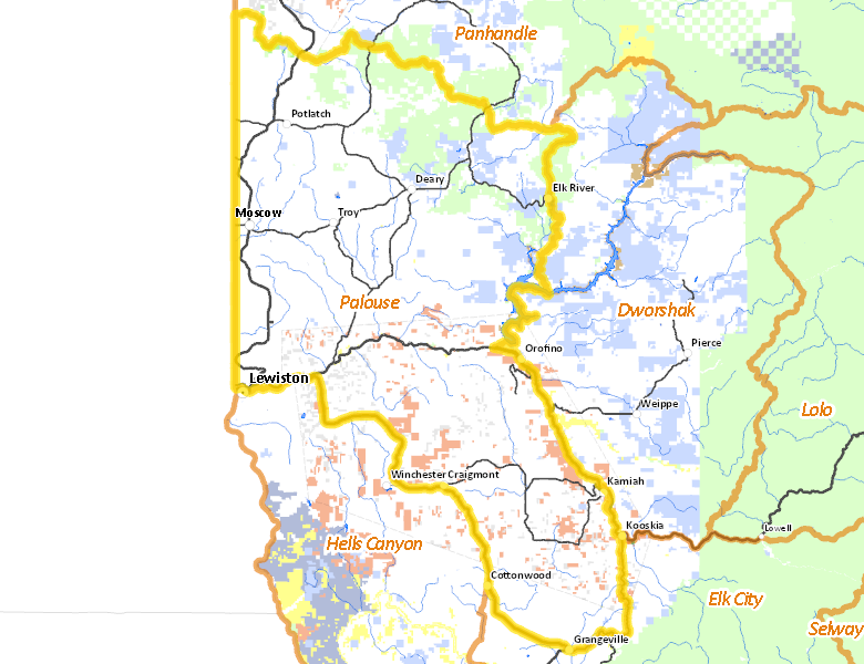
More information about GMU(s) in Palouse Zone :
Public Access
Land Ownership
| Private |  79.99
%
79.99
%
|
| U.S. Forest Service (USFS) |
8.54
%
|
| State of Idaho |
4.17
%
|
| Indian Reservation / Bureau of Indian Affairs |
4.15
%
|
| Indian Reservation / Bureau of Indian Affairs |
2.22
%
|
| Other |
0.3
%
|
| State of Idaho |
0.22
%
|
| U.S. Corps of Engineers (COE) |
0.2
%
|
| U.S. Bureau of Land Management (BLM) |
0.16
%
|
| State of Idaho |
0.04
%
|
Make your own map of Palouse Zone
Ownership data source: Inside Idaho
Access Yes! Properties
No properties are currently available in Palouse Zone.
View all Access Yes Participants.
National Forests
Federally-designated Wilderness Areas
There are no wilderness areas in Palouse Zone.
Land Use/Cover
| Dryland Agriculture |
76.88
%
|
| Forest |
22.31
%
|
| Water |
0.56
%
|
| Urban |
0.25
%
|
| Rangeland |
0
%
|
Make your own map of Palouse Zone
Land Use data source: IDWR
Services
Lodging, Camping & Services in Palouse Zone
- Lewiston, US 95 US 12
- Moscow, US 95
- Grangeville, US 95
- Orofino, US 12
- Kamiah, US 12
- Cottonwood, US 95
- Craigmont / Winchester, US 95
- Troy, Idaho 8
- Potlatch, Idaho 6 US 95
- Kooskia, US 12 Idaho 13
- Deary, Idaho 8
- Elk River, Idaho 8
* Services pages courtesy of the Official Idaho Travel and Tourism Guide