Idaho Hunt Planner We got game.
Hells Canyon Zone
Units 11, 13, 18
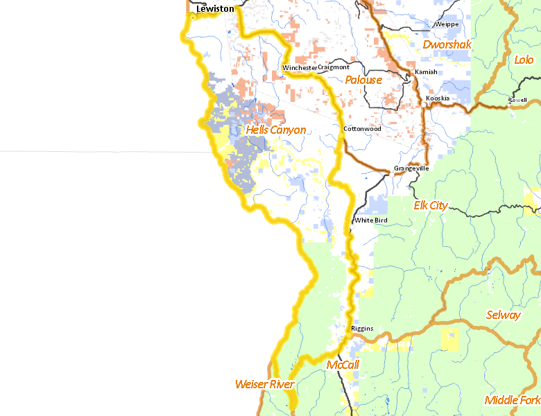
More information about GMU(s) in Hells Canyon Zone :
Hunting Opportunities in Hells Canyon Zone
Public Access
Land Ownership
| Private |  55.86
%
55.86
%
|
| U.S. Forest Service (USFS) |
17.94
%
|
| State of Idaho |
9.28
%
|
| U.S. Bureau of Land Management (BLM) |
6.49
%
|
| Indian Reservation / Bureau of Indian Affairs |
4.75
%
|
| State of Idaho |
3.47
%
|
| Indian Reservation / Bureau of Indian Affairs |
1.33
%
|
| Other |
0.4
%
|
| State of Idaho |
0
%
|
Make your own map of Hells Canyon Zone
Ownership data source: Inside Idaho
Access Yes! Properties
No properties are currently available in Hells Canyon Zone.
View all Access Yes Participants.
National Forests
Federally-designated Wilderness Areas
-
Hells Canyon Wilderness
56,535 acres (6.36% of hunt area)
Land Use/Cover
| Forest |
40.8
%
|
| Dryland Agriculture |
29.78
%
|
| Rangeland |
28.4
%
|
| Urban |
0.93
%
|
| Irrigated-Sprinkler |
0.03
%
|
Make your own map of Hells Canyon Zone
Land Use data source: IDWR
Services
Lodging, Camping & Services in Hells Canyon Zone
- Lewiston, US 95 US 12
- Cottonwood, US 95
- Craigmont / Winchester, US 95
- Riggins, US 95
* Services pages courtesy of the Official Idaho Travel and Tourism Guide